
Finding the Chinese Bridge
Located along the Deer Creek Tribute Trail in Nevada City

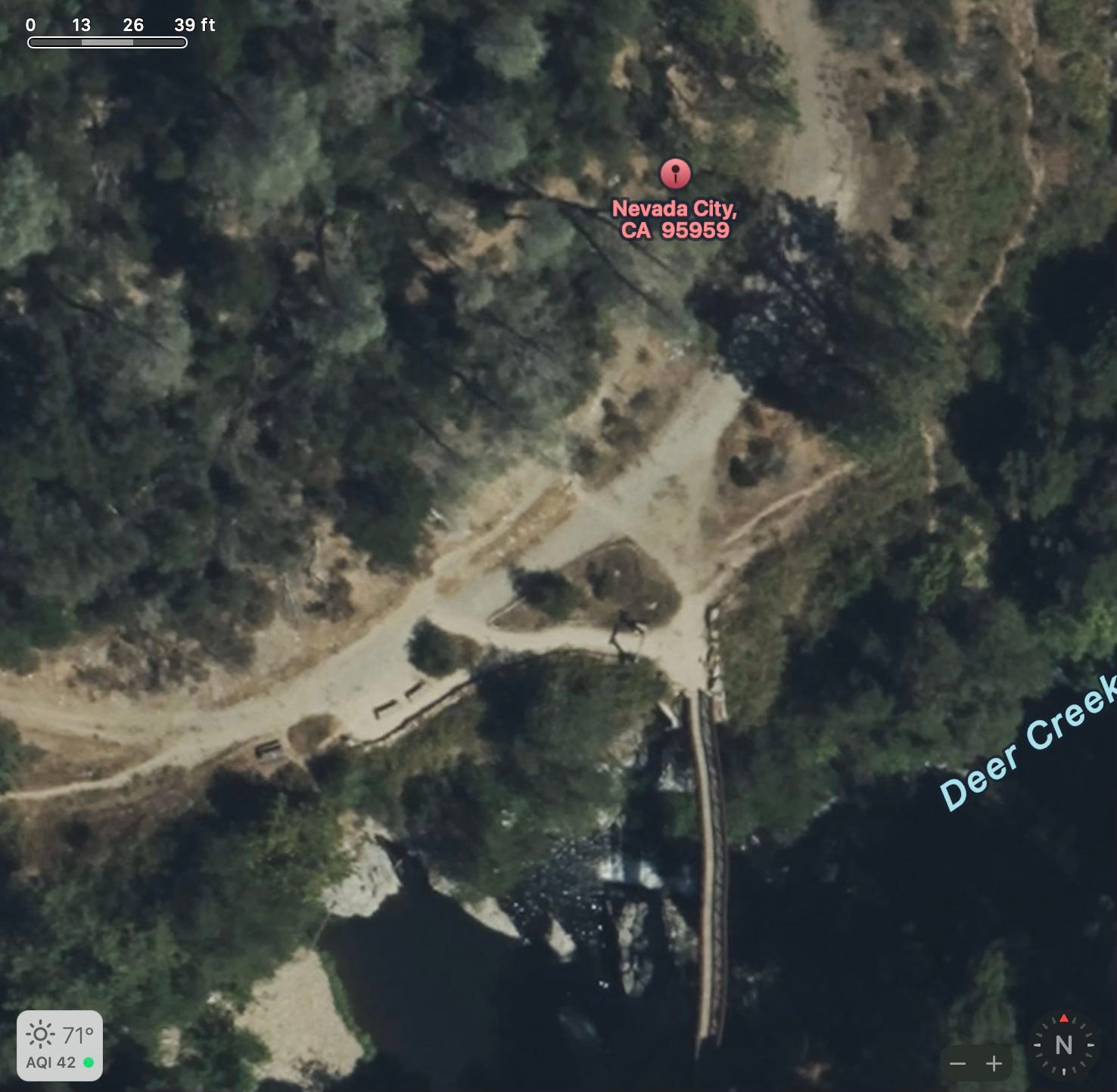
I have lived in Nevada County for around 10 years and I have been trying to find the Chinese Bridge along the Deer Creek Tribute Trail off and on for that entire time. The directions online were never clear and finding the bridge on a map has been really difficult. The suspension bridge on Deer Creek has always been easy to find but the Chinese Bridge is pretty hidden, at least for me.
After trying 4 times this weekend to locate the bridge, I was finally successful. This article will try to give the clearest directions possible.
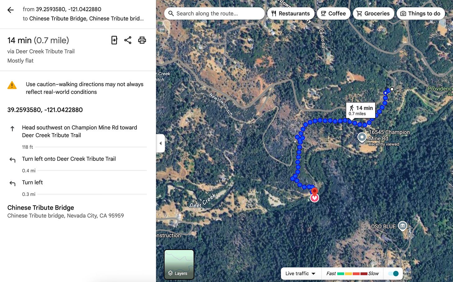
The key to finding the bridge is to locate the correct trailhead off Champion Road in Nevada City. GPS coordinates are found with each photo below.
You will find a turnout to park your car just a few feet from the trail head. From this point, the bridge is .7 miles away.
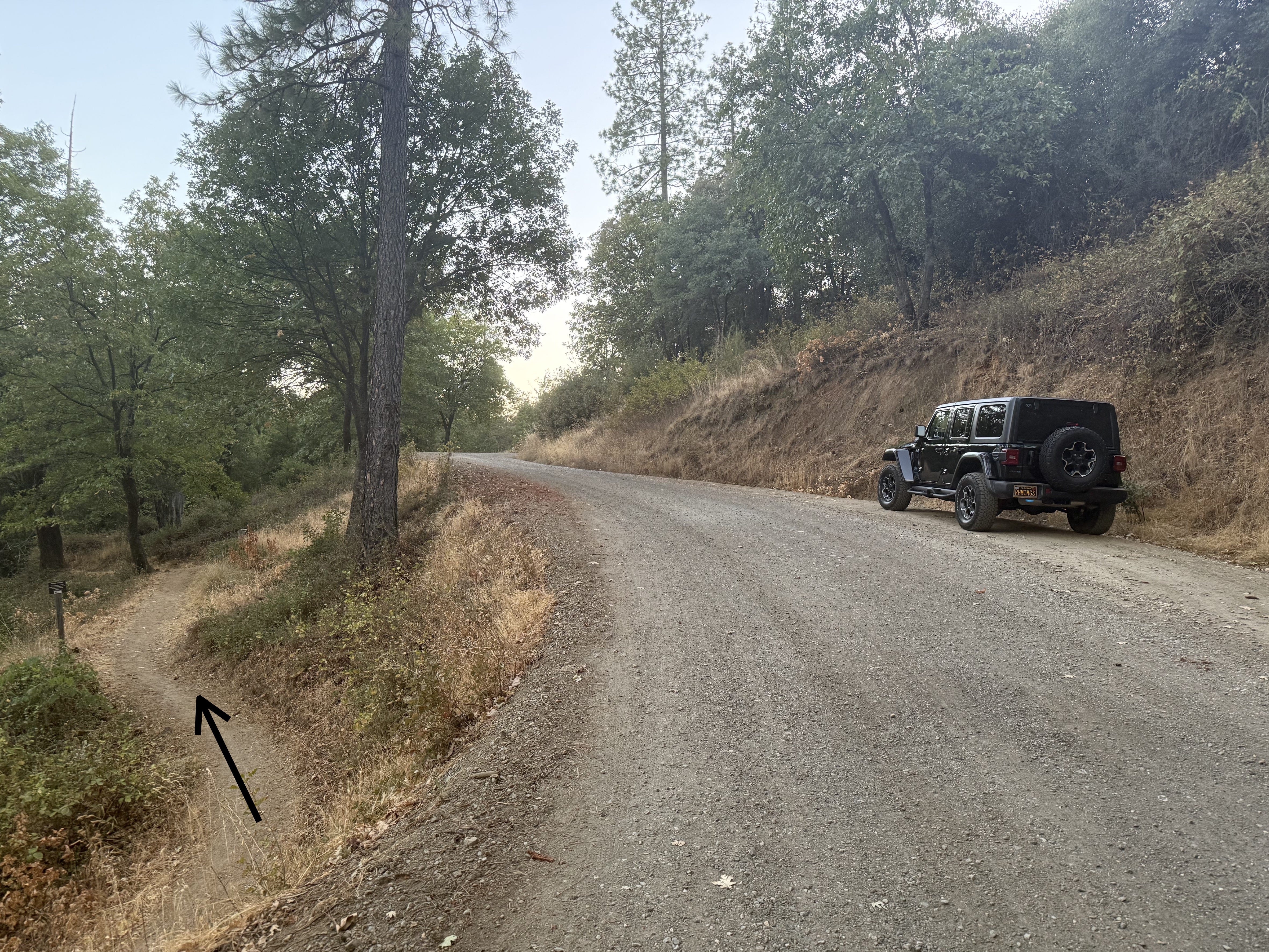
This was an ideal place to park and the trail to the left of the road starts a few feet behind me when I took this picture. A couple hundred feet up the trail will be a bench of the right side. Just past that will be a fork in the trail. If you go left and down hill, it will take you down a switchback that goes back toward the suspension bridge. Don’t go left (you will go in a long circle). Keep going straight or merge to the right.
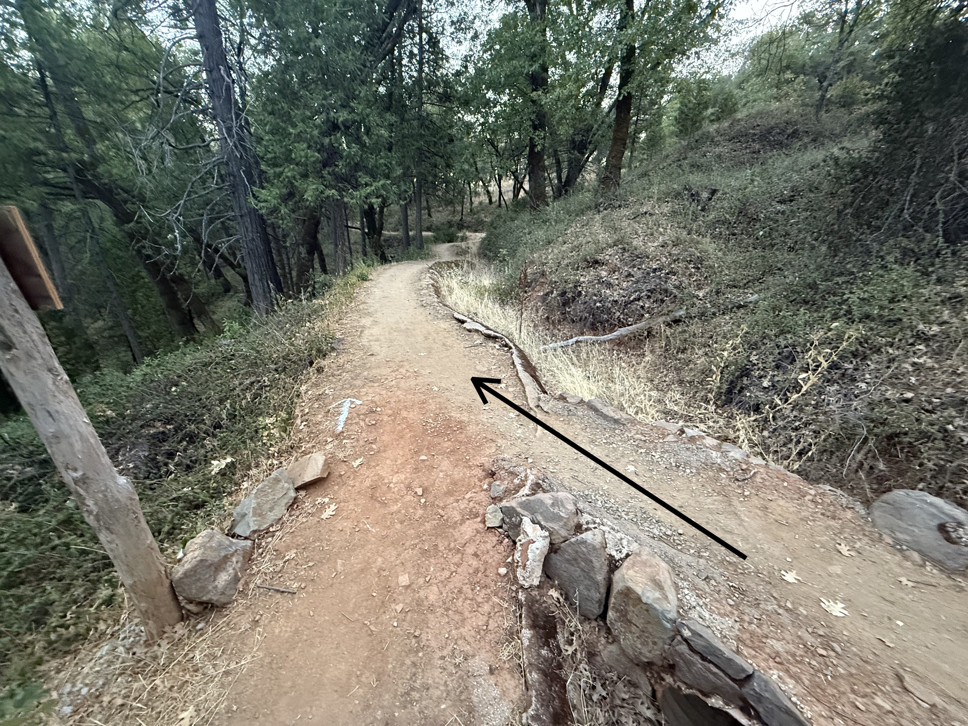
I call this Section 2 of the hike. Just up the trail is a paved driveway that you need to cross. You can actually see this driveway from Champion road.
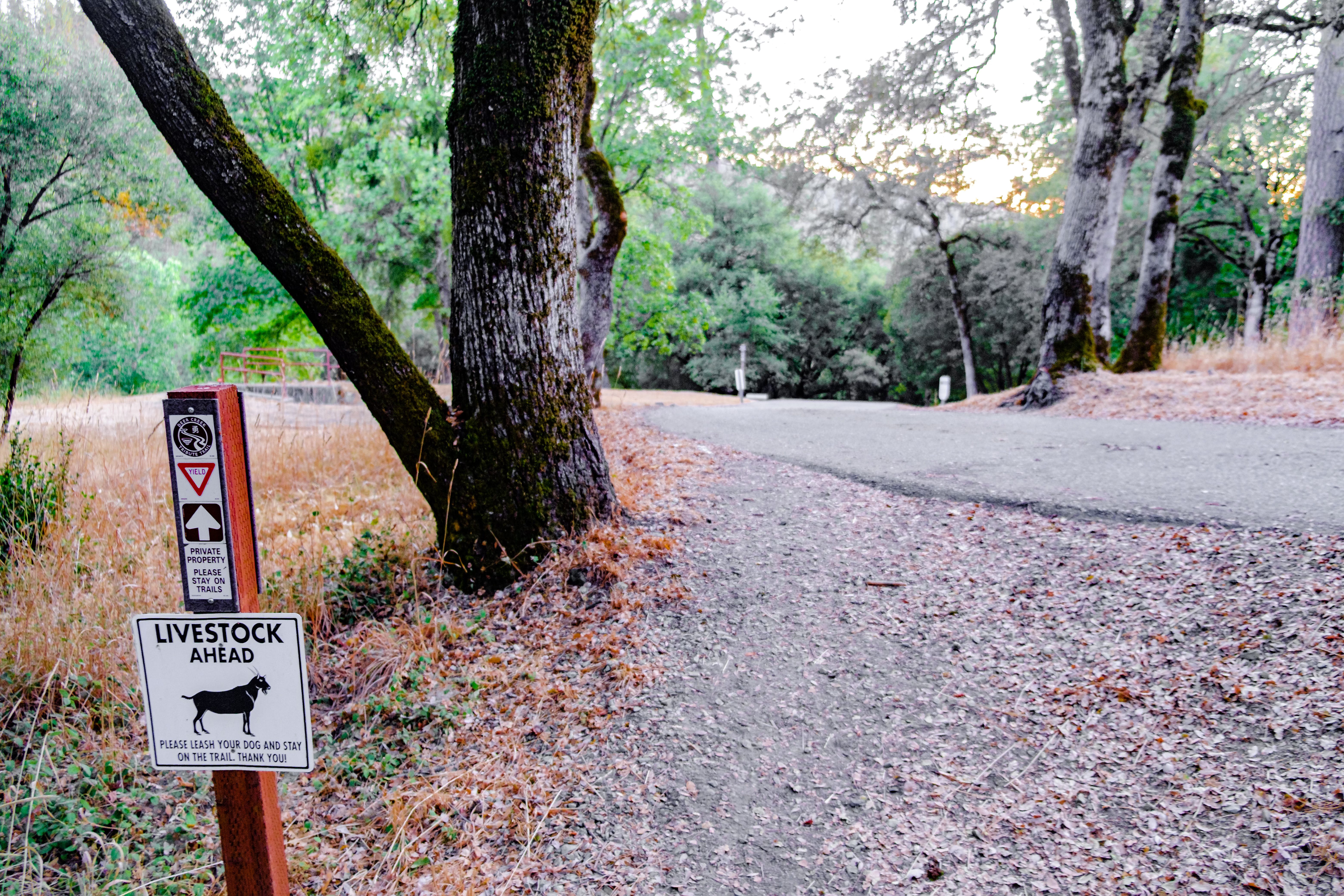
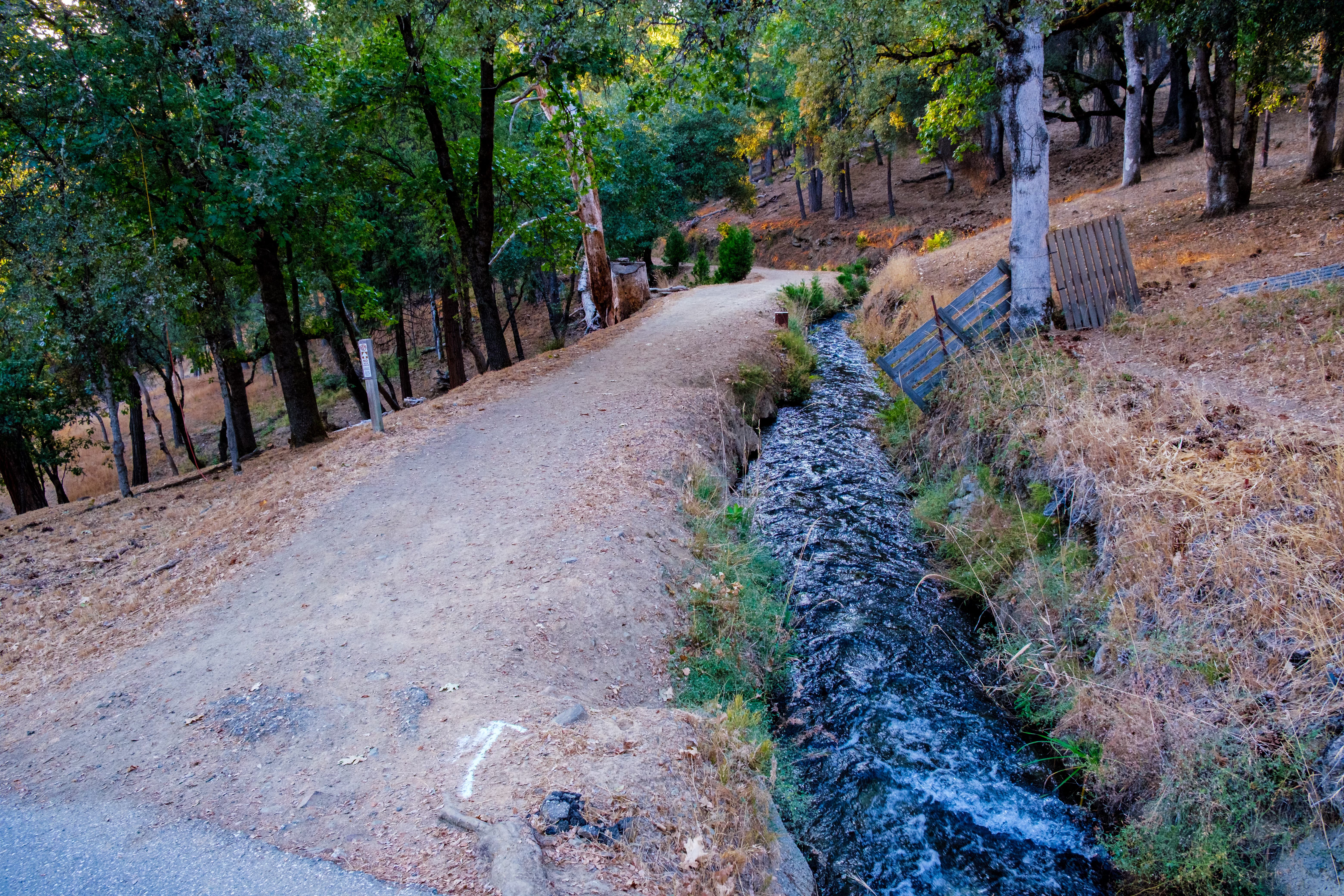
Cross the driveway and you will find Newtown Canal on the right of the trail.
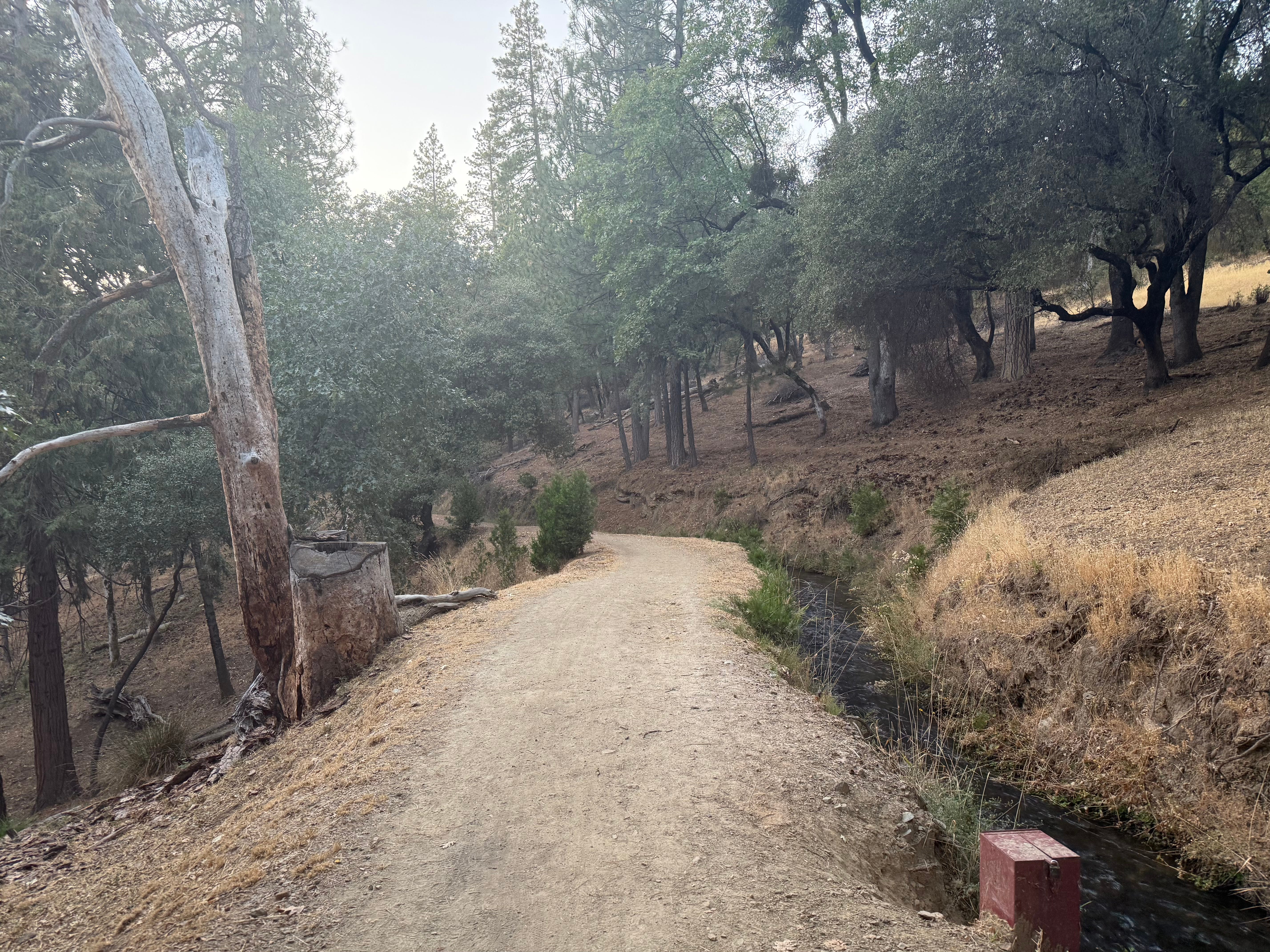
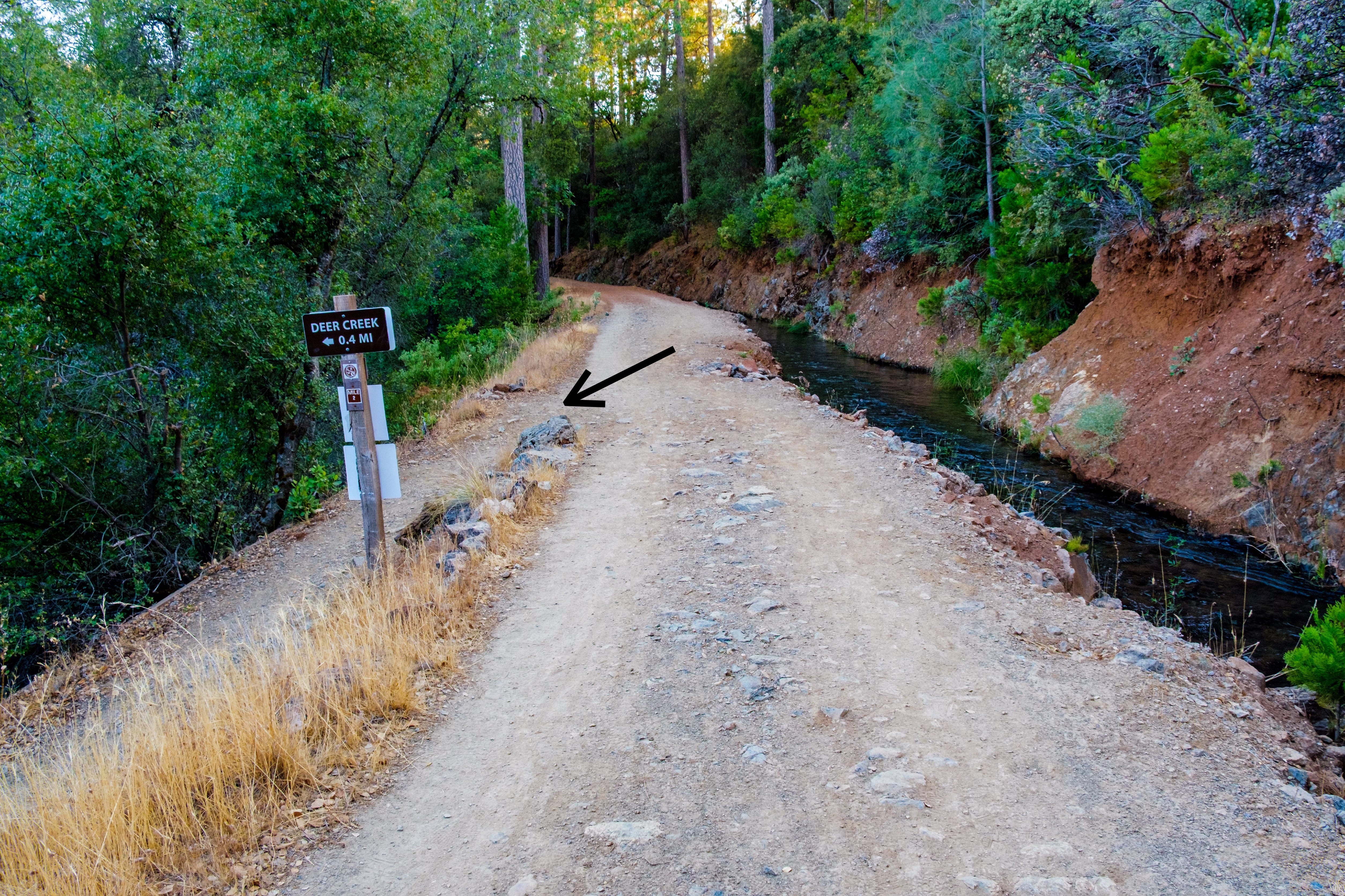
Keep walking up the trail until you see the Deer Creek sign.
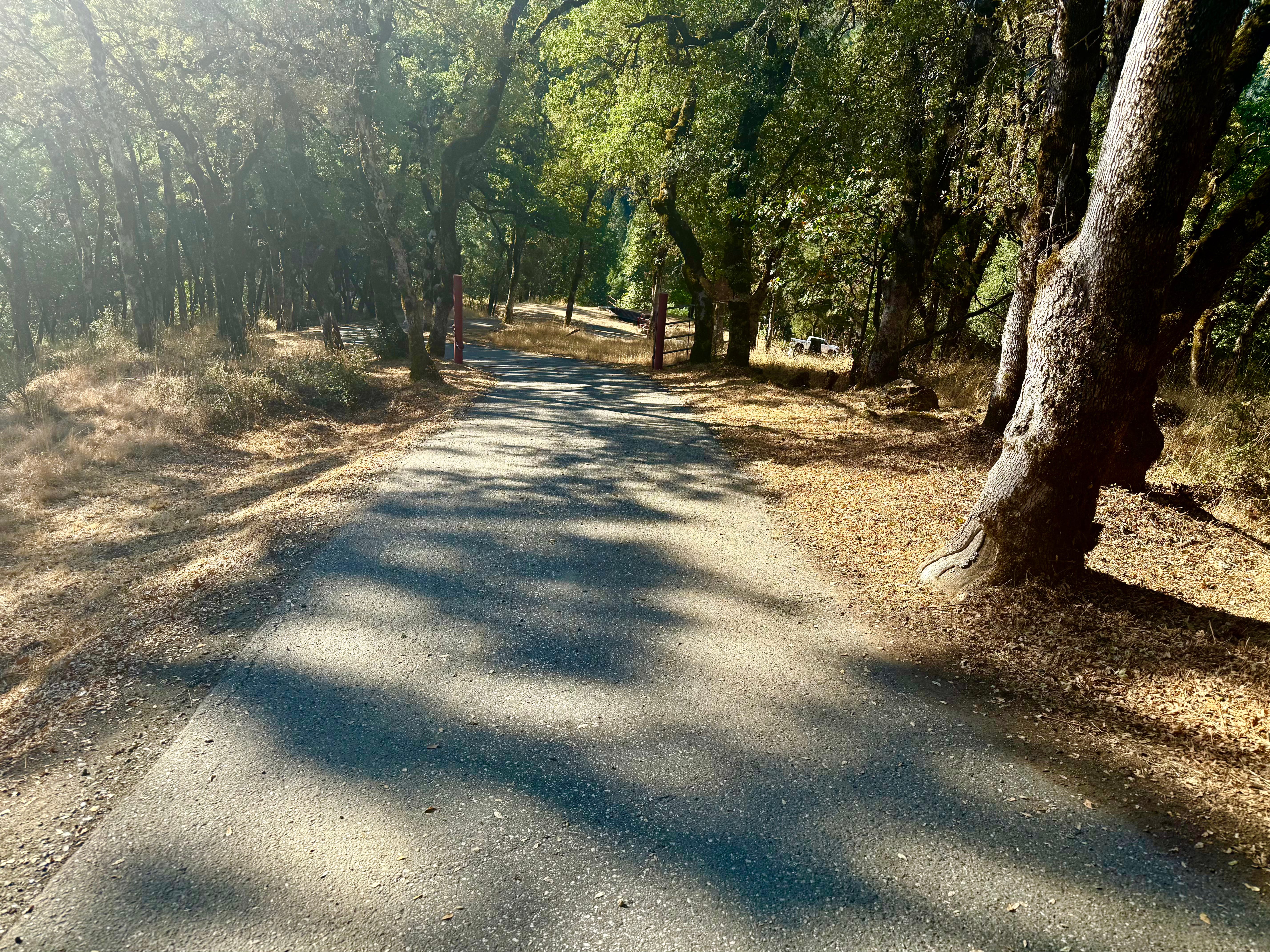
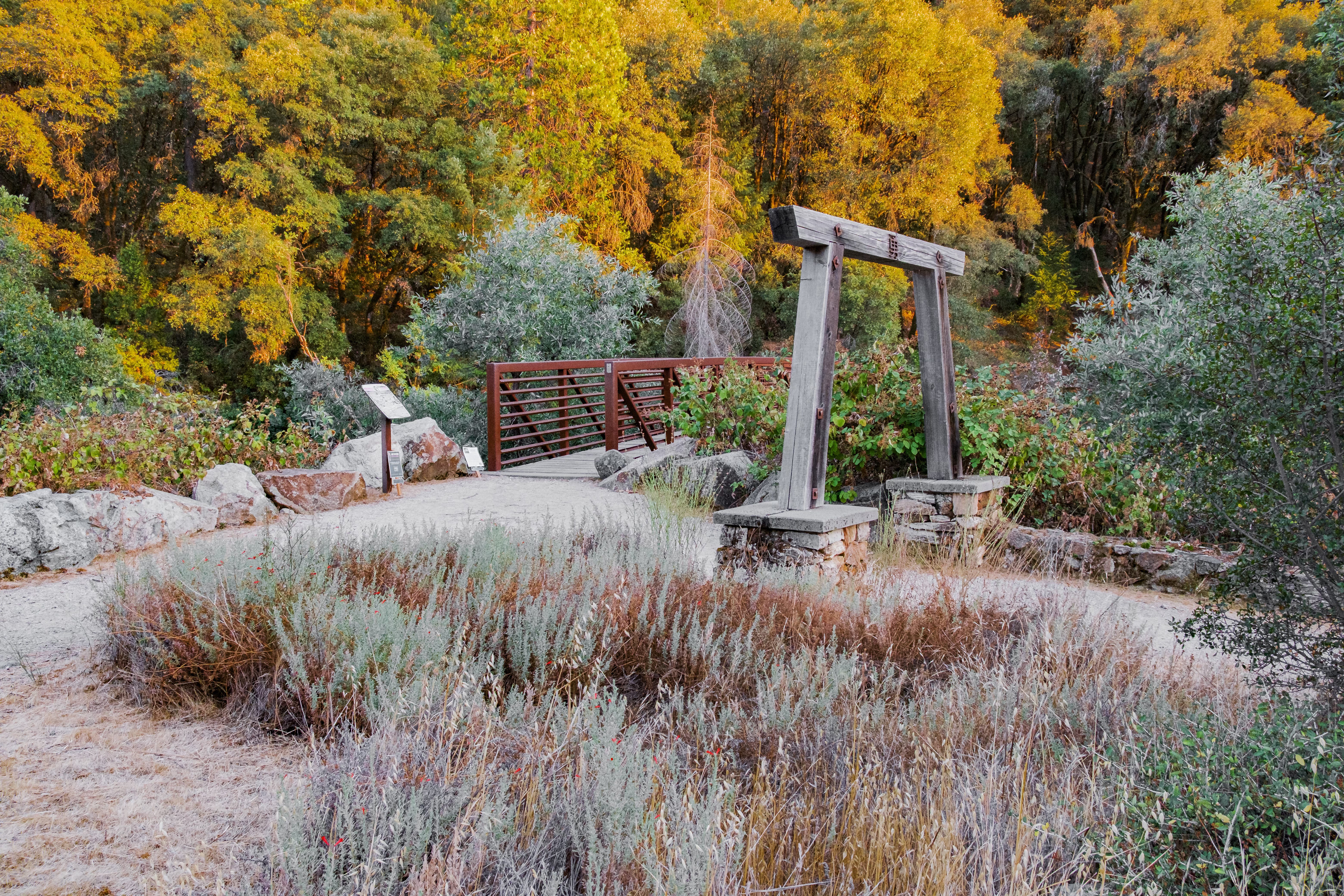
At this point you follow the trail and you can’t get lost. It is a little rocky downhill hike but not very hard. The bridge is at the bottom of the trail.
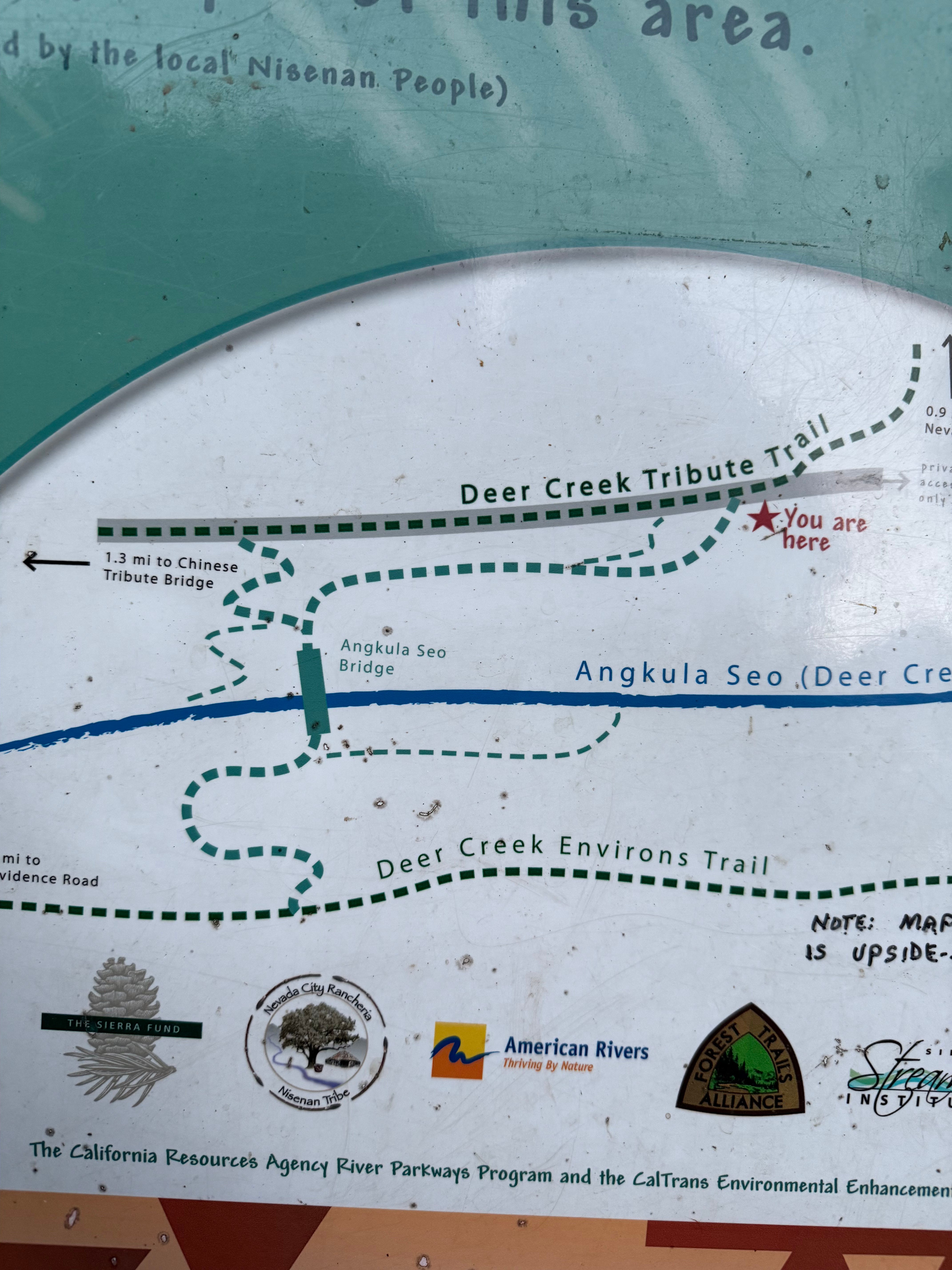
I had searched all over google (and Apple) maps and I could never find the bridge location but this is how it appears in Apple Maps
A few tips:
Don’t bother parking at the beginning of Champion Road, like you would for the suspension bridge. Just keep driving straight down Champion Road until you reach the turn out next to the trail head. Yes, you can walk from the suspension bridge, but it is a pretty long hike.
If you see this map near the suspension bridge trail head, realize it is basically upside down.
I came up with this link on Google Maps to show the trail on the map: https://maps.app.goo.gl/cFPr5dZGWL6kpMRL8
I have a series of film and digital photos of the bridge coming soon, so expect a part 2 post some time toward the end of next week.
